| OGSR Wireline By OGSR Library
July 2016 |
Hi ,
This July quarterly edition of OGSR Library's newsletter features all our usual industry updates and a couple longer articles loaded with data
downloads.
In this edition Jordan talks about accessing core at the OGSR Library. How much is available, how to look at it, and how to explore it from your own office. This article has a couple of free downloads and a way to visualize all of our core on a map.
The OGSR Library is lucky enough to get a team of great students every
summer. This year's students provide a fresh perspective on the Ontario oil and natural gas industry in their article.
We hope you enjoy reading and find some useful resources below!
OGSR Library Team
|
Getting to the Core of the Data by Jordan Clark, Manager | Ontario Petroleum Industry: A Student Perspective
by Maia, Josh, Liz and Bayden | Monthly Drilling Report - June 2016
by OGSR Library Team
|
Continue Reading for Full Stories
|
Getting to the Core of the Data Core -- what is it good for? Absolutely everything according to a wave of researchers
from the petroleum industry, government, and academia that have been busy scouring the OGSR Library core archives. In fact, core research increased by 100% from 2014 to 2015 and 500% from 2012 to 2015. 2016 is on track to be a banner year for core lab utilization at the OGSR Library. Most of the interest in 2016 is coming from government research and research by various universities throughout Ontario and a couple in Western Canada. Researchers have been looking for petroleum, salt, aquifers,
storage areas, heavy metals, and other minerals. The OGSR Library core lab is open to anyone wishing to do research into Ontario's subsurface, the tips and free downloads below should help you get the most out of this important public archive!
How much core is there?
The OGSR Library warehouses about 1050 cores from 1000 different wells. The total length of
core available is about 56 kilometres. Cores are distributed across Ontario with the greatest concentrations in Lambton county and nearly 400 from Lake Erie. Core located outside of the traditional petroleum exploration areas have recently interested academics and other industries; 34 cores are located in the Ottawa area, 63 cores are located in the Hudson Bay / James Bay area, and 150 cores are located in southwestern Ontario outside of the main petroleum exploration areas. As new cores are
drilled a portion of them must be submitted to the Library. Slabbing and boxing of core can also be done at the OGSR Library facility. Figure 1 below shows the distribution of most cores. Figure 1: Distribution of cores from southern Ontario warehoused at the OGSR
Library.
How do I find cores?
Figure 2: Example of a core record available on a wellcard.
How can I find a core covering a specific formation?
Staff at
the OGSR Library can assist you in finding cores for any application. Cores covering specific formations is by far the most popular request, so we have created a free download for our newsletter readers that will help you do just that! The spreadsheet below lists all cores available at the OGSR Library and the estimated overlap with geologic formations as recorded in the Ontario Petroleum Data System:
How about viewing and
sampling?
Everyone has access to view core at the Library. Viewing can be arranged by contacting [email protected] in advance to secure space in the lab and allow staff to
prepare core. Warehouse fees apply to the moving of core boxes and non-members pay a small hourly or daily use fee for using the sample lab area. Access to the sample lab area includes microscopes, basic tools, and some basic chemicals for testing.
Sampling can be done for clients by OGSR Library staff. Samples can be taken from most cores for most purposes, OGSR Library staff would be happy to discuss with you before your arrival or during your visit. As a public
archive we often require some data to be shared at a future date in exchange for removing samples from core. In some cases data from previous core analyses can already be found in our well files and a collection of thin sections from returns already exists on-site.
Core digitizing
The OGSR Library has been very busy over the last decade digitizing records of all types. Most well files,
geophysical logs, and production data is now available in tabular and scanned format through our website; about half a million images and millions of rows of data are available. Rocks have proven slightly more difficult to jam into the Internet but thanks to a donation from oil producer Charlie Fairbank and several large orders from the Ontario Geological Survey a catalogue of core photos is taking shape.
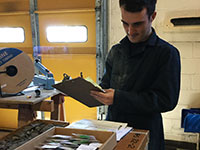
Anyone can request photos for any core at a small per box charge.
Three photos are always taken for each box, as seen in figure 3: dry, wet, and ultraviolet fluorescence. Photos are very high resolution, please see sample download below: Figure 3: Thumbnails of three core boxes from core 894
The Library is always working on
expanding the catalogue of photos, even between orders. About 5,000 boxes of core should be photographed by the end of 2016 and members will enjoy at least thumbnail access to all photos. Hopefully this will help accelerate your exploration and get you interested in looking at even more interesting cores in person at the Library.
We hope the core catalogue continues to be a popular draw for the Library and our growing database of photos will help you locate interesting
cores quickly. See you in the core lab!
|
Ontario Petroleum Industry: A Student
Perspective It is not yet common knowledge that Ontario is the true origin of oil and gas exploration. A student’s perspective originates in their education, and commonly what a student learns has shifted from a
regional to a global context. For example, Western Geography and Earth Science students are unaware of University of Western Ontario Well No. 4 drilled on their own campus. The sheer quality and quantity of the data made available to us through our employment at the OGSR Library has broadened our outlooks on Southern
Ontario geology. From well cores to geophysical logs, from historical maps to publications, the data available is constantly being corrected, organized and analyzed. These databases offer the opportunity to develop ongoing projects, and to strategize new approaches for day-to-day operations. As well as understanding the data, we are creating new tools for the users of the library. Over the past two months each of us has been challenged to learn and to think … outside the core
box. Bayden Hodgins
Grade 12 High School Student
I was recently hired by the OGSR Library to take core photos for the summer. Before I had been hired and started work here, I had little to no understanding of geography or geology. I have learned that there are a lot of different rocks types and layers. My favorite rock is the salt rock, I like how much the salt is compacted within a core. I didn’t know that oil and gases were hiding underground with the oil pushing down the water and the gas pushing down the oil,
to make it into the shape of a dome. In my time here I have also been educated that rocks were on the Earth way before anything else, and that human life is nothing compared to the time-scale of rocks. Coming to work every day has been a consistent learning environment and experience for me, regardless of if it is core photos or filing. The people who work here always have a fun fact or something to tell you about what they do and what they have learned, that you would have never known before.
Over all my experience here at the OGSR Library has been very educational.
Figure 1: Core Box containing salts
Elizabeth Sutherland
Honours Specialization Geographic Information Sciences (BSc)
The field of geology is one that I touched only very briefly in my undergraduate degree. I chose to persue GIS the moment I recognized maps as tools, and I chose to study at Western the day I saw their Map and Data Library. The Library allows me to interpret the databases as opposed to just maintaining them. Over the past two months, I’ve discovered that the applicability of mapping to geology is at the core of the OGSRL goals.
Starting at the Library, I was most surprised
to learn that Ontario’s Oil and Gas Industry is more than historical. Although activity has slowed down in recent years, companies are still exploring and searching for that next big discovery. At first glance of the petroleum well shapefile, the landscape appears completely pockmarked by points. I mistakenly assumed these were all active wells and wondered how the industry could only be producing 1% of Canada’s oil and gas. While Ontario may fall short to Alberta’s production volume, the
province has a rich historical background. The Oil Springs discovery in 1858 was only the beginning of the industry in Ontario, which has since developed into more than 26,000 wells. In spite of current industry inactivity, the data obtained by 158 years of drilling is still relevant and available at the Library.
As a GIS Technician and map-enthusiast, I consume my time with determining methods to analyze and present mass quantities of data. The forms and records on file at the OGSR
facility were painstakingly processed and digitized over the past years to create a database consisting of millions of fields. The result is an invaluable tool to our users: the ability to spatially interpret the OGSR’s geology data. The quantity of spatial data available calls for the ability to sort and query the columns, rows and fields. Learning how to manipulate this metadata outside of the familiar ESRI software will be an ongoing process.
Along with producing and completing
client maps and requests, I am currently working on data quality checks, anomaly mapping and prioritization for the GSC’s hydrostratigraphy project. Ensuring our formation data is correct and removing anomalous points will help improve the quality of the data provided by the library. I am looking forward to developing my geology and skills and learning as much as I can about the oil and gas industry. Through my duties, I have come to realize that ArcGIS is to database management as drift
is to geology: the surface. And that the exploration and discovery of a well’s data is sometimes just as important as the exploration and discovery of the oil and gas.
Figure 2: Edited OGSRL Logo with Liz and Maia at Sulphur Springs
Josh Laughton Honours Specialization Geology (BSc)
Surprisingly, before I started working at the library I was not well informed about the geology of Southern Ontario despite coming from a local university. The field and lab exercises I have experienced through university are focused more on the Precambrian rocks of Northern Ontario or globally significant geologic areas. So just like the other students, I did not actually know a whole lot about the geology or the industry in the area. The only geologic information I knew
about Southern Ontario before coming to the library was that sediments were deposited into the Michigan Basin during the Early to Middle Paleozoic with the strata dipping slightly towards the centre of the basin. At the time I was not even aware of the Appalachian Basin or that thousands of petroleum wells have been drilled here. Coming to the end of my university degree I was convinced there was little work available as a geologist in Southern Ontario. However, I have now seen
there still is an industry, and I am now more interested than ever to stay and do research here within the sedimentary strata of Southern Ontario.
At the library there are many projects for the summer students to complete. As the geology summer student I am leading the core photography project. The objective of this project is to make the thousands of core boxes, which we have stored in the library, digitally available for our users for quick and easy access. For
each core box we take three separate photos, a regular photo of the box under white light, a photo of the box after it has been wetted, and a photo taken under fluorescent light. We believe these detailed photos of the core boxes will be exceptionally useful for our clients in the years to come. Eventually, we are planning on having every single core box in our library digitally available though the OGSR website.
Along with core photography I also help Maia,
another summer student, map out the bedrock topography of Southern Ontario. Through analysis of geophysical well logs, and/or well cuttings we are able to make corrections to the top of bedrock picks. For example if there is a Hamilton Group pick surrounded by Kettle Point Formation picks then it is our job to check the validity of that pick and make the proper adjustments. Using our geology knowledge we have learned from university and the knowledge we have recently gained
about Southern Ontario geology through the library, we are able to properly verify formation picks.
Going into my final year of university I am thankful to have worked for the OSGR as I may never had known about the geological opportunities available in Southern Ontario.
Figure 3 (Top): Geology summer student Josh at Enbridge Rig Tour
Figure 4 (Left): Example of a wetted core photo within the Amherstburg
Formation.
Figure 5 (Right): Example of a fluorescent core photo showing oil staining within the Bois Blanc Formation.
Maia Somers
Honours Double Major Geology and Geography (BSc)
I have learned an incredible amount about the petroleum industry and the geology of Southern Ontario through the databases, core library and field opportunities here that I have experienced in my first two months of work. Since I have begun working here at the Library I have realized just how little I knew about the Resource Industry in Ontario. I have learned of the extensive time and planning, that must go into to digging water wells, mining for salt or
drilling for Oil and Gas. I have had the opportunity to tour an oil rig wearing flame retardant coveralls, explore a reef outcrop to learn about one of the great natural storage containers for oil and gas, and to work with core and cuttings every day in the OGSR Library’s extensive core warehouse. Through these experiences I have learned the invaluable role geology plays in oil, gas and resource exploration. I now understand how a geologist’s work can impact the industry and what techniques they
use to research and consult companies on potential drilling areas. I have had the experience analyzing stratigraphic cross sections from wells, picking formations from well logs, and distinguishing between different formations in cores and cuttings.
As well as expanding on my knowledge in geology, I have also
had the opportunity to get a better grasp working with big data in software such as ArcGIS. I have begun to understand how valuable it can be to analyze immense amounts of data geographically. Visualization of a study area is a crucial tool in any research in the industry. I have had the opportunity help generate maps to use and manipulate data to search for patterns, which may aid in future oil and gas exploration.
This summer I am leading a project that will be a starting
point for the honours thesis I will complete in my final year at Western. I will combine what I have learned from my studies and discoveries in my work at the library. I will analyze the Palaeozoic geology of Southern Ontario to accurately determine the contacts between surfaces of the bedrock below the drift. I hope to then use this to draw comparisons between the bedrock geology and the bedrock topography of Southern Ontario. This project is an instrumental opportunity for me to combine
everything I have learned in my fields of study and collaborate valuable information to be used by the industry and for research in the future. Surrounded by the abundant data available and such an amazing team of co-workers I have little doubt that the final product of my work will be as solid as the bedrock that lies beneath us.
Figure 6: Summer student, Maia, analyzing samples from
cuttings
|
June 2016 New Licences
Issued
| Licence No. | Issue Date | Operator | County | Township | Status | TD (m) | | #00011 | 2016/06/20 | Thurber Engineering Ltd. | City of Toronto | York |
|
|
New Licences Issued for Existing Wells
| Licence No. | Issue Date | Operator | County | Township | Status | TD (m) | | T012488 | 2016/06/30 | Superior View Gas Inc. | Haldimand | Moulton | GP/SUS | 180 | | T012489 | 2016/06/30 | Superior View Gas Inc. | Haldimand | Canborough | GP/SUS | 184.1 | | T012490 | 2016/06/30 | Superior View Gas Inc. | Haldimand | Moulton | GP/SUS | 188.67 |
|
Wells Plugged
| Licence
No. | Plug Date | Operator | County | Township | Status | TD (m) | | T008030 | 2015/11/0 | K+S Windsor Salt Ltd. | Essex | Sandwich West | SM/ABD | 492.2 | | T002379A | 2016/05/29 | Nith River Petroleums Limited | Oxford | Blandford | GPOS/ABD | 891.54 | | T011291 | 2016/06/02 | Lambton Area Industries Ltd. | Lambton | Enniskillen | HOP/ABD |
| | T012080 | 2011/09/27 | Regional Municipality of Peel | Peel | Toronto | OBS/ABD | 70.7 | | T012470 | 2016/06/20 | Superior View Gas Inc. | Haldimand | Canborough | GP/ABD | 195.68 | | T012085 | 2011/06/24 | Regional Municipality of Peel | Peel | Toronto | STR/ABD | 54.59 | | T012478 | 2016/04/15 | ref_ae55c19cf3905e6bce8f1ee03b59edda | Lambton | Enniskillen | PGP/ABD |
| | T012472 | 2016/02/15 | Wikwemikong Unceded / Indian Oil and Gas Canada | Manitoulin | Indian Reserve no. 26 | OS/ABD |
| | T012477 | 2016/02/15 | Wikwemikong Unceded / Indian Oil and Gas Canada | Manitoulin | Indian Reserve no. 26 | GS/ABD |
| | T008031 | 2015/11/20 | K+S Windsor Salt Ltd. | Essex | Sandwich West | SM/ACT | 480.9 |
|
|
Quick Tip: Get raw material for thin sections here
Although the Library does not make thin sections we can supply you with raw cut samples to have your own made. We also have an extensive collection of existing thin sections. If you have thin sections you no longer need don't
dispose of them, send the to the Library for public viewing.
If you are having trouble viewing this newsletter, it can be viewed here.
What is the OGSR Library?
The Ontario Oil, Gas & Salt Resources Library is a not-for-profit corporation that manages all of Ontario's public drilling
and production data from the petroleum and solution mined salt industries. This includes processing, storing, and providing safe and convenient access to all of the industry's drill core and rock cuttings. The Library makes as much of this data as possible available through our online portal to members all over the world. The financial support of the petroleum industry and our membership make this possible.
|
Follow:

|
|
|
|
|